You are in: Asia -> Laos -> Vat Phou and Associa... , and traditional search or Image Gallery will yield results of this site only
Vat Phou and Associated Ancient Settlements within the Champasak Cultural Landscape
| Site number: | 481 |
|
| Type of site: | Cultural | |
| Date: | 5-15th century | |
| Date of Inscription: | 2001 | |
| Location: | Asia, Lao People's Democratic Republic, Champasak Province | |
Up to 75 images are shown here. Click on each for more details or on Image Gallery for more images.
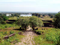
| Description: | The Champasak cultural landscape, that includes the Vat Phou Temple complex, is an astonishingly well-preserved landscape that was planned and erected more than 1,000 years ago. Set on an axis from mountain top to river bank, the site was laid over some 10 km in a geometric pattern of temples, shrines and waterworks; it was deliberately created in this certain way to convey the Hindu vision of nature’s and humanity’s relationship. Also a part of the site is the Phou Kao mountain and two planned cities, located on the banks of the Mekong River. The whole characterizes a development spanning the centuries from the 5th to 15th, and is mainly associated with the Khmer Empire. --WHMNet paraphrase from the description at WHC Site, where additional information is available. For 360 degree imaging of this site, click here. | |
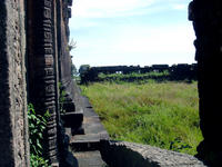
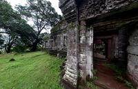
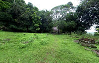
| Wat Phou (Vat Phu) is a ruined Khmer temple complex in southern Laos. It is located at the base of mount Phu Kao, some 6 km from the Mekong river in Champassak province. There was a temple on the site as early as the 5th century, but the surviving structures date from the 11th to 13th centuries. The temple has a unique structure, in which the elements lead to a shrine where a linga was bathed in water from a mountain spring. The site later became a centre of Theravada Buddhist worship, which it remains today. Wat Phou was initially associated with the city of Shrestapura, which lay on the bank of the Mekong directly east of mount Lingaparvata (now called Phu Kao). By the latter part of the 5th century the city was already the capital of a kingdom which texts and inscriptions connect with both Chenla and Champa, and the first structure on the mountain was constructed around this time. The mountain gained spiritual importance from the linga-shaped protuberance on its summit; the mountain itself was therefore considered the home of Shiva, and the river as representing the ocean or the Ganges River. The temple was naturally dedicated to Shiva, while the water from the spring which emerges directly behind the temple was considered sacred. Wat Phou was a part of the Khmer empire, centred on Angkor to the southwest, at least as early as the reign of Yashovarman I in the early 10th century. Shrestapura was superseded by a new city in the Angkorian period, located directly south of the temple. In the later period, the original buildings were replaced, re-using some of the stone blocks; the temple now seen was built primarily during the Koh Ker and Baphuon periods of the 11th century. Minor changes were made during the following two centuries, before the temple, like most in the empire, was converted to Theravada Buddhist use. This continued after the area came under control of the Lao, and a festival is held on the site each February. Little restoration work has been done, other than the restoration of boundary posts along the path. Wat Phou was designated a World Heritage Site in 2001. --Wikipedia. Text is available under the Creative Commons Attribution-ShareAlike License. For 360 degree imaging of this site, click here. | ||
| Rights of Image: | www.World-Heritage-Tour.org | |
| Source: | http://whc.unesco.org/en/list/481 | |
| Source2: | http://whc.unesco.org/en/list/481/video | |
| Reference: | 1. UNESCO World Heritage Center, Site Page. | |


