You are in: Oceania -> New Zealand -> Tongariro National Park, and traditional search or Image Gallery will yield results of this site only
Tongariro National Park
| Site number: | 421 |
|
| Type of site: | Mixed | |
| Date of Inscription: | 1990, 1993 | |
| Location: | Zealandia, New Zealand, Tongariro and Wanganui Regions, North Island | |
Up to 75 images are shown here. Click on each for more details or on Image Gallery for more images.
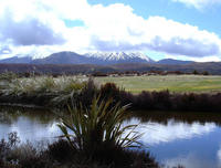
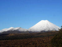
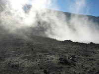
| Description: | Tongariro was the first property on the World Heritage List to be inscribed under the revised criteria describing cultural landscapes (in 1993). Rising high above the park, at its heart, are the culturally and religiously significant mountains, for the local Maori people they represent the spiritual associations between this community and its environment. The park boasts both active and extinct volcanoes, an assorted collection of ecosystems and several amazing landscapes. --WHMNet paraphrase from the description at WHC Site, where additional information is available. | |
| Tongariro National Park is the oldest national park in New Zealand, located in the central North Island. It has been acknowledged by UNESCO as one of the 24 mixed cultural and natural World Heritage Sites. Tongariro National Park was the fourth National Park established in the world. The active volcanic mountains Ruapehu, Ngauruhoe, and Tongariro are located in the centre of the park. There are a number of Māori religious sites within the park, such as one at the grave to Te Heuheu Herekeikei. The summits of Tongariro, Ngauruhoe and Ruapehu are tapu (sacred). The mountain summits are of great significance to the local Māori. To prevent exploitation of the mountains by European immigrants, Te Heuheu Tukino IV (Horonuku), the most significant chief of the Māori Ngati Tuwharetoa iwi (or clan), gifted the heart of the current national park, consisting of the peaks of Mount Tongariro, Mount Ngauruhoe, and parts of Mount Ruapehu, to The Crown on September 23, 1887, on condition that a protected area was established there. This 26.4 km² area was generally considered to be too small to establish a national park after the model of Yellowstone National Park in Wyoming (USA), and so further areas were bought. When the New Zealand Parliament passed the Tongariro National Park Act in October 1894, the park covered an area of about 252.13 km², but it took until 1907 to acquire the land. When the Act was renewed in 1922, the park area was extended to 586.8 km². Further extensions, especially Pihanga Scenic Reserve in 1975, enlarged the park to its current size of 795.98 km². The last modification to the Act was passed in 1980. Tongariro National Park has been under the control of the New Zealand Department of Conservation since the creation of the department in 1987. The volcanoes Tongariro, Ngauruhoe and Ruapehu are the southern end of a 2500 km long range of volcanoes, below which the Indo-Australian Plate meets the Pacific Plate.These volcanoes have resulted from internal tectonic processes. The Pacific Plate subducts under the Indo-Australian plate, and subsequently melts due to the high temperatures of the aesthenosphere. This magma being less dense, rises to the surface and goes through the weak parts of the earth's crust(the faults) resulting in volcanic processes in the area. Volcanic processes have been causing the uplift of the mountains of Tongariro National Park for over two million years. --Wikipedia. Text is available under the Creative Commons Attribution-ShareAlike License. | ||
| Source: | http://whc.unesco.org/en/list/421 | |
| Reference: | 1. UNESCO World Heritage Center, Site Page. | |


