You are in: Asia -> Turkey -> Göreme National Par... , and traditional search or Image Gallery will yield results of this site only
Göreme National Park and the Rock Sites of Cappadocia
| Site number: | 357 |
|
| Type of site: | Mixed | |
| Date: | 4th-century | |
| Date of Inscription: | 1985 | |
| Location: | Eurasia, Turkey, Nevşehir Province (Cappadocia) in Central Anatolia | |
Up to 75 images are shown here. Click on each for more details or on Image Gallery for more images.
Six official UN languages:
Arabic,
Chinese,
English,
French,
Russian,
Spanish
Other languages: Azerbaijani, Catalan, Croatian, Czech, Danish, Dutch, Esperanto, Farsi, Finnish, German, Greek, Hebrew, Hungarian, Icelandic, Italian, Japanese, Korean, Latvian, Norwegian-bokmål, Polish, Portuguese, Romanian, Serbian, Swedish, Turkish, Welsh
Other languages: Azerbaijani, Catalan, Croatian, Czech, Danish, Dutch, Esperanto, Farsi, Finnish, German, Greek, Hebrew, Hungarian, Icelandic, Italian, Japanese, Korean, Latvian, Norwegian-bokmål, Polish, Portuguese, Romanian, Serbian, Swedish, Turkish, Welsh
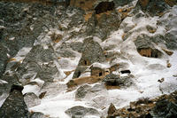
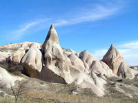
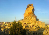
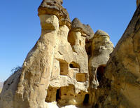
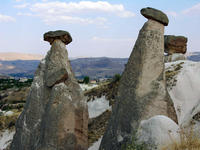
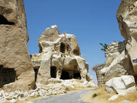
| Description: | Within a magnificent landscape, sculpted in full by erosion, the Göreme valley and its environs enclose rock-hewn sanctuaries that offer exceptional Byzantine art of the post-Iconoclastic period. this site also showcases the remnants of a traditional human habitat dating back to the 4th century, which consists of dwellings, troglodyte villages and underground towns. --WHMNet paraphrase from the description at WHC Site, where additional information is available. | |
| Title: Göreme; Göreme (Greek: Κόραμα ("Korama")), located among the "fairy chimneys" rock formations, is a town in Cappadocia, a historical region of Turkey. It is in the Nevşehir Province in Central Anatolia. The Göreme National Park (Göreme Milli Parklar in Turkish) was added to the UNESCO World Heritage List in 1985. The first period of settlement within the region reaches to Roman period of Christianity era. Among historical sites are Ortahane, Durmus Kadir, Yusuf Koc and Bezirhane churches in Göreme, including Tokali Kilise, the Apple Church, houses and shafts engraved from rocks. Title: Cappadocia: In ancient geography, Cappadocia or Capadocia, Turkish Kapadokya (from Persian: Katpatuka meaning "the land of beautiful horses", Greek: Καππαδοκία / Kappadokía) was the name of the extensive inland district of Asia Minor (modern Turkey). The name continued to be used in western sources and in the Christian tradition throughout history and is still widely used as an international tourism concept to define a region of exceptional natural wonders characterized by fairy chimneys and a unique historical and cultural heritage. The term, as used in tourism, roughly corresponds to present-day Nevşehir Province of Turkey. It is impossible to define Cappadocia's limits with any real accuracy. In the time of Herodotus, the Cappadocians are supposed to have occupied the whole region from Mount Taurus to the vicinity of the Euxine (Black Sea). Cappadocia, in this sense, was bounded in the south by the chain of Mount Taurus, to the east by the Euphrates, to the north by Pontus, and to the west vaguely by the great salt lake, Lake Tuz, in Central Anatolia. But Strabo, the only ancient author who gives any circumstantial account of the country, greatly exaggerated its dimensions. It is now believed that 400 km east-west by 200 km north-south is a more realistic appraisal of Cappadocia's extension. --Wikipedia. Text is available under the Creative Commons Attribution-ShareAlike License. | ||
| Source: | http://whc.unesco.org/en/list/357 | |
| Source2: | http://whc.unesco.org/en/list/357/video | |
| Reference: | 1. UNESCO World Heritage Center, Site Page. | |


