You are in: South America -> Argentina -> Los Alerces National... , and traditional search or Image Gallery will yield results of this site only
Los Alerces National Park
| Site number: | 1526 |
|
| Type of site: | Natural | |
| Date of Inscription: | 2017 | |
| Location: | South America, Argentina, Chubut Province | |
Up to 75 images are shown here. Click on each for more details or on Image Gallery for more images.
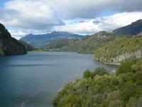
| Description: | The Los Alerces National park is located in the Andes of northern Patagonia and has a western boundary, which coincides with the Chilean border. Successive glaciations have moulded the landscape in the region creating spectacular features such as moraines, glacial cirques and clear-water lakes. The vegetation is dominated by dense temperate forests, which give way to alpine meadows higher up under the rocky Andean peaks. The property is vital for the protection of some of the last portions of continuous Patagonian Forest in an almost pristine state and is the habitat for a number of endemic and threatened species of flora and fauna. --WHMNet's description is from WHC Site, where additional information is available.CC-BY-SA IGO 3.0. | |
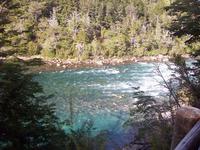
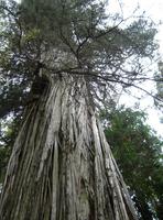
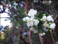
| The Los Alerces National Park (Spanish: Parque Nacional Los Alerces) is a national park in Chubut Province, Argentina, some 30 miles (50 km) from Esquel. It is a park of 2,630 square kilometres along the border with Chile, best known for the alerce (lahuán) trees (Fitzroya cupressoides) from which the park takes its name. Designated a World Heritage Site in 2017, the park was created in 1937 in order to protect the alerce forest, and other typical examples of the flora of the Patagonian Andes. The National Park has the largest alerce forest of Argentina. Alerce is one of the longest-living trees in the world; some in the park are around 3,000 years old, with many of them over 1,000 years. It grows very slowly and belongs to the family Cupressaceae. The principal forest in the park, visited by tourists, is at Puerto Sagrario at the northern end of Lago Menéndez. Arrayán (Luma apiculata) trees can be seen along the Arrayanes river. --Wikipedia. Text is available under the Creative Commons Attribution-ShareAlike License. CC-BY-SA IGO 3.0. |
||
| Source: | http://whc.unesco.org/en/list/1526. Description is available under license. CC-BY-SA IGO 3.0. | |
| Source2: | Wikipedia (http://wikipedia.com). CC-BY-SA IGO 3.0. | |
| Reference: | 1. UNESCO World Heritage Center (http://whc.unesco.org/en/list/1526). 2. Wikipedia. CC-BY-SA IGO 3.0. | |


