You are in: North America -> Mexico -> Archipiélago de Rev... , and traditional search or Image Gallery will yield results of this site only
Archipiélago de Revillagigedo
| Site number: | 1510 |
|
| Type of site: | Natural | |
| Date of Inscription: | 2016 | |
| Location: | North American, Mexico, Eastern Pacific Ocean | |
Up to 75 images are shown here. Click on each for more details or on Image Gallery for more images.
Six official UN languages:
Arabic,
Chinese,
English,
French,
Russian,
Spanish
Other languages: Azerbailani, Basque (Euskara), Bulgarian, Catalan, Croatian, Czech, Dutch, Esperanto, Finnish (suomi), Galician (Galego), Georgian, German, Hungarian, Italian, Japanese, Korean, Latvian, Lithuanian, Persian, Polish, Portuguese, Serbian, Swedish, Thai, Vietnamese
Other languages: Azerbailani, Basque (Euskara), Bulgarian, Catalan, Croatian, Czech, Dutch, Esperanto, Finnish (suomi), Galician (Galego), Georgian, German, Hungarian, Italian, Japanese, Korean, Latvian, Lithuanian, Persian, Polish, Portuguese, Serbian, Swedish, Thai, Vietnamese
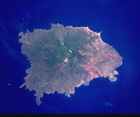
| Description: | Located in the eastern Pacific Ocean, this archipelago is made up of four remote islands and their surrounding waters: San Benedicto, Socorro, Roca Partida and Clarión. This archipelago is part of a submerged mountain range, with the four islands representing the peaks of volcanoes emerging above sea level. The islands provide critical habitat for a range of wildlife and are of particular importance for seabirds. The surrounding waters have a remarkable abundance of large pelagic species, such as manta rays, whales, dolphins and sharks. --WHMNet's description is from WHC Site, where additional information is available. | |
| The Revillagigedo Islands (Spanish: Islas Revillagigedo, IPA: [reˈβiʝa xiˈxeðo]) or Revillagigedo Archipelago are a group of four volcanic islands in the Pacific Ocean, known for their unique ecosystem. They lie approximately 390 kilometres (240 mi) southwest of Cabo San Lucas, the southern tip of the Baja California Peninsula, and 720 to 970 kilometres (450 to 600 mi) west of Manzanillo. They are located around 18°49′N 112°46′WCoordinates: 18°49′N 112°46′W. The islands have been part of Manzanillo municipality of the Mexican state of Colima since 1861, but are nevertheless under Mexican federal jurisdiction. In July 2016, the Revillagigedo Archipelago were inscribed as a World Heritage Site. --Wikipedia. Text is available under the Creative Commons Attribution-ShareAlike License. | ||
| Source: | http://whc.unesco.org/en/list/1510 | |
| Source2: | Wikipedia (http://wikipedia.com) | |
| Reference: | 1. UNESCO World Heritage Center (http://whc.unesco.org/en/list/1510). 2. Wikipedia. | |


