You are in: Middle East -> Iran -> The Persian Qanat, and traditional search or Image Gallery will yield results of this site only
The Persian Qanat
| Site number: | 1506 |
|
| Type of site: | Cultural | |
| Date of Inscription: | 2016 | |
| Location: | Middle East, Iran | |
Up to 75 images are shown here. Click on each for more details or on Image Gallery for more images.
Six official UN languages:
Arabic,
Chinese,
English,
French,
Russian,
Spanish
Other languages: Azerbaijani, Catalan, Croatian, Czech, Danish, Dutch, Esperanto, Farsi, German, Hebrew, Hungarian, Italian, Japanese, Lithuanian, Malay (Baahasa Malay), Norwegian-bokmĺl, Polish, Portuguese, Serbo-Croatian, Simple English, Slovenian, Swedish , Turkish, Ukrainian
Other languages: Azerbaijani, Catalan, Croatian, Czech, Danish, Dutch, Esperanto, Farsi, German, Hebrew, Hungarian, Italian, Japanese, Lithuanian, Malay (Baahasa Malay), Norwegian-bokmĺl, Polish, Portuguese, Serbo-Croatian, Simple English, Slovenian, Swedish , Turkish, Ukrainian
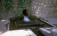
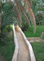
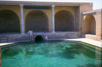
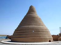
| Description: | Throughout the arid regions of Iran, agricultural and permanent settlements are supported by the ancient qanat system of tapping alluvial aquifers at the heads of valleys and conducting the water along underground tunnels by gravity, often over many kilometres. The eleven qanats representing this system include rest areas for workers, water reservoirs and watermills. The traditional communal management system still in place allows equitable and sustainable water sharing and distribution. The qanats provide exceptional testimony to cultural traditions and civilizations in desert areas with an arid climate. --WHMNet's description is from WHC Site, where additional information is available. | |
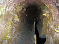
| A qanāt (Persian: قنات/کاریز) is a gently sloping underground channel with a series of vertical access shafts, used to transport water from an aquifer under a hill. Qanāts create a reliable supply of water for human settlements and irrigation in hot, arid, and semi-arid climates. The qanat technology is known to have been developed in Iran by the Persian people sometime in the early 1st millennium BC, and spread from there slowly westward and eastward. The value of the qanat is directly related to the quality, volume, and regularity of the water flow. Much of the population of Iran and other arid countries in Asia and North Africa historically depended upon the water from qanats; the areas of population corresponded closely to the areas where qanats are possible. Although a qanat was expensive to construct, its long-term value to the community, and thereby to the group that invested in building and maintaining it, was substantial. --Wikipedia. Text is available under the Creative Commons Attribution-ShareAlike License. | ||
| Source: | http://whc.unesco.org/en/list/1506 | |
| Source2: | Wikipedia (http://wikipedia.com) | |
| Reference: | 1. UNESCO World Heritage Center (http://whc.unesco.org/en/list/1506). 2. Wikipedia. | |


