You are in: Africa -> Namibia -> Namib Sand Sea, and traditional search or Image Gallery will yield results of this site only
Namib Sand Sea
| Site number: | 1430 |
|
| Type of site: | natural | |
| Date of Inscription: | 2013 | |
| Location: | Africa, Namibia, Angola, Atlantic coasts | |
Up to 75 images are shown here. Click on each for more details or on Image Gallery for more images.
Six official UN languages:
Arabic,
Chinese,
English,
French,
Russian,
Spanish
Other languages: Afrikaans, Albanian (Shqip), Armenian, Basque (Euskara), Belarusian, Belarusian- Tarashkyevich, Breton, Bulgarian, Catalan, Croatian, Czech, Danish, Dutch, Esperanto, Estonian, Finnish (suomi), Georgian, German, Hebrew, Hungarian, Icelandic (Islanska), Indonesian, Italian, Japanese, Kazakh (Turkish), Kiswahili, Korean, Lithuanian, Malay (Baahasa Malay), Malayalam, Mongolian, Norwegian-bokmål, Norwegian-nynorsk, Polish, Portuguese, Punjabi, Romana, Slovenian, Swedish, Tamil, Thai, Turkish, Ukrainian, Urdu, Vietnamese
Other languages: Afrikaans, Albanian (Shqip), Armenian, Basque (Euskara), Belarusian, Belarusian- Tarashkyevich, Breton, Bulgarian, Catalan, Croatian, Czech, Danish, Dutch, Esperanto, Estonian, Finnish (suomi), Georgian, German, Hebrew, Hungarian, Icelandic (Islanska), Indonesian, Italian, Japanese, Kazakh (Turkish), Kiswahili, Korean, Lithuanian, Malay (Baahasa Malay), Malayalam, Mongolian, Norwegian-bokmål, Norwegian-nynorsk, Polish, Portuguese, Punjabi, Romana, Slovenian, Swedish, Tamil, Thai, Turkish, Ukrainian, Urdu, Vietnamese
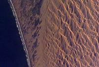
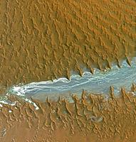
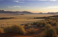
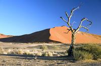
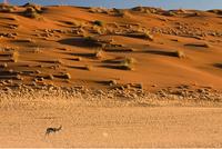
| Description: | Namib Sand Sea is the only coastal desert in the world that includes extensive dune fields influenced by fog. Covering an area of over three million hectares and a buffer zone of 899,500 hectares, the site is composed of two dune systems, an ancient semi-consolidated one overlain by a younger active one. The desert dunes are formed by the transportation of materials thousands of kilometres from the hinterland, that are carried by river, ocean current and wind. It features gravel plains, coastal flats, rocky hills, inselbergs within the sand sea, a coastal lagoon and ephemeral rivers, resulting in a landscape of exceptional beauty. Fog is the primary source of water in the site, accounting for a unique environment in which endemic invertebrates, reptiles and mammals adapt to an ever-changing variety of microhabitats and ecological niches. --WHMNet's description is from WHC Site, where additional information is available. | |
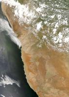
| The Namib is a coastal desert in southern Africa. The name Namib is of Nama origin and means "vast place". According to the broadest definition, the Namib stretches for more than 2,000 kilometres (1,200 mi) along the Atlantic coasts of Angola, Namibia, and South Africa, extending southward from the Carunjamba River in Angola, through Namibia and to the Olifants River in Western Cape, South Africa. The Namib's northernmost portion, which extends 450 kilometres (280 mi) from the Angola-Namibia border, is known as Moçâmedes Desert, while its southern portion approaches the neighboring Kalahari Desert. From the Atlantic coast eastward, the Namib gradually ascends in elevation, reaching up to 200 kilometres (120 mi) inland to the foot of the Great Escarpment. Annual precipitation ranges from 2 millimetres (0.079 in) in the most arid regions to 200 millimetres (7.9 in) at the escarpment, making the Namib the only true desert in southern Africa. Having endured arid or semi-arid conditions for roughly 55-80 million years, the Namib is also the oldest desert in the world. The Namib Desert is one of the 500 distinct physiographic provinces of the South African Platform physiographic division. It occupies an area of around 80,950 km²[5] (31,200 square miles), stretching from the Usiab River (north) to the town of Lüderitz (south) and from the Atlantic Ocean (west) to the Namib Escarpment (east). It is about 1,000 miles (1,600 km) long from north to south and its east-west width varies from 30 to 100 miles (50–160 km). To the north, the desert leads into the Kaokoveld; the dividing line between these two regions is roughly at the latitude of the city of Walvis Bay, and it consists in a narrow strip of land (about 50 km wide) that is the driest place in Southern Africa. To the south, the Namib borders on the South African Karoo semi-desert. --Wikipedia [http://www.wikipedia.org]. Text is available under the Creative Commons Attribution- | ||
| Source: | http://whc.unesco.org/en/list/1430 | |
| Source2: | Wikipedia (http://wikipedia.com) | |
| Reference: | 1. UNESCO World Heritage Center (http://whc.unesco.org/en/list/1430). 2. Wikipedia. | |


