You are in: North America -> Mexico -> El Pinacate and Gran... , and traditional search or Image Gallery will yield results of this site only
El Pinacate and Gran Desierto de Altar Biosphere Reserve
| Site number: | 1410 |
|
| Type of site: | Natural | |
| Date of Inscription: | 2013 | |
| Location: | North American, Mexico, Sonora | |
Up to 75 images are shown here. Click on each for more details or on Image Gallery for more images.
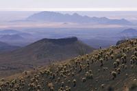
| Description: | The 714,566 hectare site comprises two distinct parts: the dormant volcanic Pinacate Shield of black and red lava flows and desert pavements to the east, and, in the west, the Gran Altar Desert with its ever changing and varied sand dunes that can reach a height of 200 metres. This landscape of dramatic contrast notably features linear, star and dome dunes as well as several arid granite massifs, some as high as 650 metres. The dunes emerge like islands from the sea of sand and harbour distinct and highly diverse plant and wildlife communities, including endemic freshwater fish species and the endemic Sonoran Pronghorn, which is only to be found in northwestern Sonora and in southwestern Arizona (USA). Ten enormous, deep and almost perfectly circular craters, believed to have been formed by a combination of eruptions and collapses, also contribute to the dramatic beauty of the site whose exceptional combination of features are of great scientific interest. The site is also a UNESCO Biosphere Reserve. --WHMNet's description is from WHC Site, where additional information is available. | |
| El Pinacate y Gran Desierto de Altar Biosphere Reserve (Spanish: Reserva de la Biosfera El Pinacate y Gran Desierto de Altar), is a biosphere reserve and UNESCO World Heritage Site managed by the Federal government of Mexico, specifically by Secretariat of the Environment and Natural Resources, in collaboration with state government of Sonora and the Tohono O'odham. It is in the Sonoran Desert in Northwest Mexico, east of Gulf of California, in the eastern part Gran Desierto de Altar, just below the border of Arizona, United States and north of the city of Puerto Peñasco. It is one of the most significant visible landforms in North America seen from space. A volcanic system, known as Santa Clara is the main part of the landscape, including three peaks; Pinacate, Carnegie and Medio. In the area there are over 540 species of plants, 40 species of mammals, 200 of birds, 40 of reptiles, also amphibians and freshwater fishes. There are threatened endemic species as sonoran pronghorn, bighorn sheep, gila monster and desert tortoise. The extension of the Biosphere Reserve is 7,146 km², greater than that of the states of Aguascalientes, Colima, Morelos and Tlaxcala separated. --Wikipedia. Text is available under the Creative Commons Attribution-ShareAlike License. | ||
| Source: | http://whc.unesco.org/en/list/1410 | |
| Source2: | Wikipedia (http://wikipedia.com) | |
| Reference: | 1. UNESCO World Heritage Center (http://whc.unesco.org/en/list/1410). 2. Wikipedia. | |


