You are in: Asia -> Turkey -> Neolithic Site of Ç... , and traditional search or Image Gallery will yield results of this site only
Neolithic Site of Çatalhöyük
| Site number: | 1405 |
|
| Type of site: | Cultural | |
| Date: | Neolithic Age - | |
| Date of Inscription: | 2012 | |
| Location: | Middle East, Turkey, Konya | |
Up to 75 images are shown here. Click on each for more details or on Image Gallery for more images.
Six official UN languages:
Chinese,
English,
French,
Russian,
Spanish
Other languages: Azerbaijani, Basque, Bulgarian, Catalan, Croatian, Czech, Danish, Dutch, Estonian, Finnish (Suomi), Georgian, German, Greek, Hebrew, Hungarian, Italian, Japanese, Latvian, Lithuanian, Norwegian-Bokmai, Polish, Portuguese, Sardinian, Swedish, Turkish, Ukrainian
Other languages: Azerbaijani, Basque, Bulgarian, Catalan, Croatian, Czech, Danish, Dutch, Estonian, Finnish (Suomi), Georgian, German, Greek, Hebrew, Hungarian, Italian, Japanese, Latvian, Lithuanian, Norwegian-Bokmai, Polish, Portuguese, Sardinian, Swedish, Turkish, Ukrainian
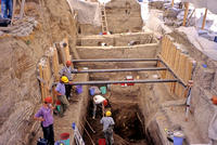
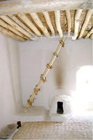
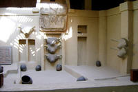
| Description: | Two hills form the 37 ha site on the Southern Anatolian Plateau. The taller eastern mound contains eighteen levels of Neolithic occupation between 7400 bc and 6200 bc, including wall paintings, reliefs, sculptures and other symbolic and artistic features. Together they testify to the evolution of social organization and cultural practices as humans adapted to a sedentary life. The western mound shows the evolution of cultural practices in the Chalcolithic period, from 6200 bc to 5200 bc. Çatalhöyük provides important evidence of the transition from settled villages to urban agglomeration, which was maintained in the same location for over 2,000 years. It features a unique streetless settlement of houses clustered back to back with roof access into the buildings. --WHMNet's description is from WHC Site, where additional information is available. | |
| Çatalhöyük (Turkish pronunciation: [tʃaˈtaɫhøjyc]; also Çatal Höyük and Çatal Hüyük, or any of the three without diacritics; çatal is Turkish for "fork", höyük for "mound") was a very large Neolithic and Chalcolithic settlement in southern Anatolia, which existed from approximately 7500 BCE to 5700 BCE. It is the largest and best-preserved Neolithic site found to date. In July 2012, it was inscribed as a UNESCO World Heritage Site. Çatalhöyük is located overlooking wheat fields in the Konya Plain, southeast of the present-day city of Konya (ancient Iconium) in Turkey, approximately 140 km (87 mi) from the twin-coned volcano of Mount Hasan. The eastern settlement forms a mound which would have risen about 20 m (66 ft) above the plain at the time of the latest Neolithic occupation. There is also a smaller settlement mound to the west and a Byzantine settlement a few hundred meters to the east. The prehistoric mound settlements were abandoned before the Bronze Age. A channel of the Çarşamba river once flowed between the two mounds, and the settlement was built on alluvial clay which may have been favourable for early agriculture. --Wikipedia. Text is available under the Creative Commons Attribution-ShareAlike License. | ||
| Source: | http://whc.unesco.org/en/list/1405 | |
| Reference: | 1. UNESCO World Heritage Center (http://whc.unesco.org/en/list/1405). 2. Wikipedia. | |


