You are in: Middle East -> Iran -> Shushtar Historical ... , and traditional search or Image Gallery will yield results of this site only
Shushtar Historical Hydraulic System
| Site number: | 1315 |
|
| Type of site: | Cultural | |
| Date: | 5th century B.C | |
| Date of Inscription: | 2009 | |
| Location: | Asia, Iran, Khuzestan province | |
Up to 75 images are shown here. Click on each for more details or on Image Gallery for more images.
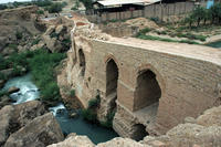
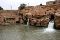
| Description: | "Shushtar, Historical Hydraulic System, inscribed as a masterpiece of creative genius, can be traced back to Darius the Great in the 5th century B.C. It involved the creation of two main diversion canals on the river Kârun one of which, Gargar canal, is still in use providing water to the city of Shushtar via a series of tunnels that supply water to mills. It forms a spectacular cliff from which water cascades into a downstream basin. It then enters the plain situated south of the city where it has enabled the planting of orchards and farming over an area of 40,000 ha. known as Mianâb (Paradise). The property has an ensemble of remarkable sites including the Salâsel Castel, the operation centre of the entire hydraulic system, the tower where the water level is measured, damns, bridges, basins and mills. It bears witness to the know-how of the Elamites and Mesopotamians as well as more recent Nabatean expertise and Roman building influence." --WHMNet paraphrase from the description at WHC Site, where additional information is available. | |
| Shûshtar (Persian: شوشتر) is an ancient fortress city in the Khuzestan province in southwestern Iran. It is approximately 92 km away from Ahvaz, the centre of the province. It had an estimated population of 89,255 in 2005. The old name of Shushtar, dating back to Achaemenian times, was Šurkutir. The name itself, Shushtar, is connected with the name of another ancient city, Susa (or Shush, in Persian pronunciation), and means "greater (or better) than Shush."During the Sassanian era, it was an island city on the Karoun river and selected to become the summer capital. The river was channelled to form a moat around the city, while bridges and main gates into Shushtar were built to the east, west, and south. Several rivers nearby are conducive to the extension of agriculture; the cultivation of sugar cane, the main crop, dates back to 226 CE. A system of subterranean channels called Ghanats, which connected the river to the private reservoirs of houses and buildings, supplied water for domestic use and irrigation, as well as to store and supply water during times of war when the main gates were closed. Traces of these ghanats can still be found in the crypts of some houses. This complex system of irrigation degenerated during the 19th century, which consequently led to Shushtar's decline as an important agricultural centre until revitalisation efforts began under the reign of the last king of Iran, Mohammad Reza Pahlavi, in 1973.When the Sassanian Shah Shapour I defeated the Roman emperor Valerian, he ordered the captive Roman soldiers to build a vast bridge and dam stretching over 550 metres, known as the Band-e Qaisar ("Caesar's bridge"). The ancient fortress walls were destroyed at the end of the Safavid era. Like other Persian ethnic groups, the people of Shushtar, called Shushtaris, maintain a unique cultural heritage stretching back to ancient times, and a Persian dialect distinct to their group. --Wikipedia. Text is available under the Creative Commons Attribution-ShareAlike License. | ||
| Source: | http://whc.unesco.org/en/list/1315 | |
| Reference: | 1. UNESCO World Heritage Center, Site Page. | |


