You are in: Europe -> Spain -> Teide National Park, and traditional search or Image Gallery will yield results of this site only
Teide National Park
| Site number: | 1258 |
|
| Type of site: | Natural | |
| Date: | - | |
| Date of Inscription: | 2007 | |
| Location: | Europe, Spain, Canary Island, Santa Cruz de Tenerife | |
Up to 75 images are shown here. Click on each for more details or on Image Gallery for more images.
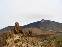
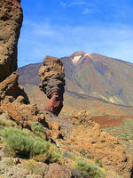
| Description: | The 18,990 ha Teide National Park, positioned on the island of Tenerife, features the highest peak in Spain the Teide-Pico Viejo stratovolcano at 3,718 m. Situated in a spectacular environment, the volcano rises 7,500m above the ocean floor, thus it is deemed the world's third tallest volcanic structure. The atmospheric conditions generate relentlessly shifting textures and tones creating an immense visual impact, accented by a ‘sea of clouds' that molds a visually exciting backdrop to the mountain. Teide is globally important in presenting evidence of the geological processes that emphasize the evolution of oceanic islands, complementing other inscribed volcanic properties, such as the Hawaii Volcanoes National Park (U.S.A.). --WHMNet paraphrase from the description at WHC Site, where additional information is available. | |
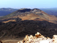
| Teide (pronounced "Tay-dee") or Pico del Teide, is a volcano on Tenerife, Canary Islands. The volcano and its surrounds comprise the Parque Nacional del Teide, an 18900 ha national park that was named a World Heritage Site by UNESCO on June 29th, 2007. At 3,718 metres (12,198 ft) above sea level, and approximately 7,500 metres (25,000 ft) above the adjacent sea bed, Teide is the highest mountain in Spain and the highest mountain in any Atlantic island. (Note: The actual summit stands 3 metres (10 ft) higher than the triangulation station, and associated bench mark, which has an altitude of 3,715 m (12,188 ft) ). The island of Tenerife itself is the third largest volcano by volume on Earth, making Tenerife the third largest volcanic island on Earth. Teide is also the third highest volcano on a volcanic ocean island. Due to its eruptive history and location close to population centres, the volcano has been designated a Decade Volcano worthy of close study to prevent future natural disasters. The volcano and its surrounds, including the whole of the Las Cañadas caldera, are protected in a national park, the Parque Nacional del Teide. Teide is currently dormant, having last erupted in 1909 from the subsidiary vent of Chinyero, on the western slope. Significant eruptions occurred in 1704, 1705 and 1706, which destroyed the town and principle port of Garachico, plus several smaller villages. Another notable eruption occurred in 1798. About 150,000 years ago, a much larger explosive eruption occurred, probably of Volcanic Explosivity Index 7.This eruption created Las Cañadas, a large caldera, at just over 2,000 m altitude. The caldera is 15 km across east-west and 10 km north-south. At Guajara, on the south side of the structure, the internal walls rise as almost sheer cliffs from 2,100 m to 2,715 m. The 3,718 m summit of Teide itself, and its sister stratovolcano, Pico Viejo (3,134 m), are both situated in the northern half of the caldera, and derive from eruptions subsequent to this prehistoric explosion. Further eruptions are considered likely in the future, including a risk of highly dangerous pyroclastic flows similar to those on Mount Pelée and Mount Vesuvius. From 2003, there has been an increase in seismic activity at the volcano, which may be indicative of magma rising into the edifice. Teide is unstable with a distinctive bulge on its northern flank. The bulge is believed to be constructed over the headwall scarp of the infilled Icod Valle, a massive landslide valley formed by edifice failure in a similar manner to that of the Guimar and Orotava Valle's. The summit of the volcano has a number of small active fumaroles emitting hot sulfur dioxide and other gases. --Wikipedia. Text is available under the Creative Commons Attribution-ShareAlike License. | ||
| Source: | http://whc.unesco.org/en/list/1258 | |
| Reference: | 1. UNESCO World Heritage Center, Site Page. | |


