You are in: Asia -> Tajikistan -> Tajik National Park ... , and traditional search or Image Gallery will yield results of this site only
Tajik National Park (Mountains of the Pamirs)
| Site number: | 1252 |
|
| Type of site: | natural | |
| Date of Inscription: | 2013 | |
| Location: | Asia, Tajikistan, Pamir Knot | |
Up to 75 images are shown here. Click on each for more details or on Image Gallery for more images.
Six official UN languages:
Chinese,
English,
French,
Russian,
Spanish
Other languages: Azerbaijani, Basque (Euskara), Belarusian, Belarusian- Tarashkyevich, Bulgarian, Catalan, Croatian, Czech, Danish, Dutch, Esperanto, Estonian, Finnish (suomi), Georgian, German, Greek, Hebrew, Hindi, Hungarian, Indonesian, Italian, Japanese, Kazakh (Turkish), Korean, Latvian, Lithuanian, Macedonian, Malayalam, Norwegian-bokmål, Norwegian-nynorsk, Pashto, Persian, Polish, Portuguese, Romana, Slovenian, Swedish, Tajik, Tatar, Turkish, Ukrainian, Urdu, Vietnamese, Welsh
Other languages: Azerbaijani, Basque (Euskara), Belarusian, Belarusian- Tarashkyevich, Bulgarian, Catalan, Croatian, Czech, Danish, Dutch, Esperanto, Estonian, Finnish (suomi), Georgian, German, Greek, Hebrew, Hindi, Hungarian, Indonesian, Italian, Japanese, Kazakh (Turkish), Korean, Latvian, Lithuanian, Macedonian, Malayalam, Norwegian-bokmål, Norwegian-nynorsk, Pashto, Persian, Polish, Portuguese, Romana, Slovenian, Swedish, Tajik, Tatar, Turkish, Ukrainian, Urdu, Vietnamese, Welsh
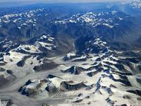
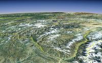
| Description: | Tajikistan National Park covers more than 2.5 million hectares in the east of the country, at the centre of the so-called “Pamir Knot”, a meeting point of the highest mountain ranges on the Eurasian continent. It consists of high plateaux in the east and, to the west, rugged peaks, some of them over 7,000 meters high, and features extreme seasonal variations of temperature. The longest valley glacier outside the Polar region is located among the 1,085 glaciers inventoried in the site, which also numbers 170 rivers and more than 400 lakes. Rich flora species of both the south-western and central Asian floristic regions grow in the Park which shelters nationally rare and threatened birds and mammals (Marco Polo Argali sheep, Snow Leopards and Siberian Ibex and more). Subject to frequent strong earthquakes, the Park is sparsely inhabited, and virtually unaffected by agriculture and permanent human settlements. It offers a unique opportunity for the study of plate tectonics and subduction phenomena. --WHMNet's description is from WHC Site, where additional information is available. | |
| he Pamir Mountains are a mountain range in Central Asia formed by the junction or knot of the Himalayas, Tian Shan, Karakoram, Kunlun, and Hindu Kush ranges. They are among the world’s highest mountains, and since Victorian times, they have been known as the "Roof of the World", presumably a translation from Persian. In other languages they are called: Kyrgyz Памир тоолору; Persian: رشته کوه های پامیر Reshte Kūh-hāye Pāmīr; Tajik: Кӯҳҳои Помир; Pashto: د پامير غرونه; Uyghur: پامىر ئېگىزلىكى; Urdu: پامیر کوهستان; simplified Chinese: 葱岭; traditional Chinese: 蔥嶺; pinyin: Cōnglǐng; Wade–Giles: Ts'ung-ling or "Onion Range" (after the wild onions growing in the region). The name "Pamir" is used more commonly in Modern Chinese and loaned as simplified Chinese: 帕米尔; traditional Chinese: 帕米爾; pinyin: Pàmǐ'ěr. The precise extent of the Pamir Mountains is debatable. They lie mostly in Gorno-Badakhshan province, Tajikistan and Badakshan Province, Afghanistan. To the north they join the Tian Shan mountains along the Alay Valley of Kyrgyzstan. To the south they join the Hindu Kush mountains along the Wakhan Corridor in Afghanistan and Gilgit–Baltistan in Pakistan. To the east they may end on the Chinese border or extend to the range that includes Kongur Tagh which is sometimes included in the Kunlun Mountains. --Wikipedia. Text is available under the Creative Commons Attribution-ShareAlike License. | ||
| Source: | http://whc.unesco.org/en/list/1252 | |
| Source2: | Wikipedia (http://wikipedia.com) | |
| Reference: | 1. UNESCO World Heritage Center (http://whc.unesco.org/en/list/1252). 2. Wikipedia. | |


