| Site number: | 1231 |
|
| Type of site: | Cultural | |
| Date: | 16th century | |
| Date of Inscription: | 2008 | |
| Location: | Africa, Kenya, along the coast | |
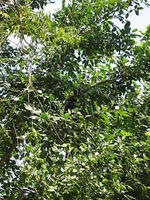
| Description: | The Mijikenda Kaya Forests contain 11 separate forest sites stretching the length of the coast for over 200 km. They, in turn, are composed of numerous fortified village remains, known as kayas, of the Mijikenda people. Created in the 16th century but deserted by the 1940s, the kayas are currently considered as ancestor abodes and are honored as sacred sites; as such, they are upheld by councils of elders. The site bears unique testimony of a cultural tradition and holds a direct link to a living tradition. -- UNESCO (whc 2008) – 1231 [http://whc.unesco.org/en/lis1231]
The Mijikenda ("the nine cities") are the nine ethnic groups along the coast of Kenya from the border of Somalia in the north to the border of Tanzania in the south. Historically, these ethnic groups have been called the Nyika or Nika by outsiders. It is a derogatory term meaning "bush people". Of the nine ethnic groups it is the Digo who are found also in Tanzania due to their proximity to the common border. They all have a sacred forest called the Kaya a place of prayer conducted by selected elders of the specific ethnic. The forest is a World Heritage Site. The Mijikenda include the Digo, Chonyi, Kambe, Duruma, Kauma, Ribe, Rabai, Jibana, and Giriama. Each have unique customs and language, although the languages are similar to each other and to Swahili. --WHMNet paraphrase from the description at WHC Site, where additional information is available. |
|
| Source: | http://whc.unesco.org/en/list/1231 | |
| Reference: | 1. UNESCO World Heritage Center, Site Page. | |


