You are in: Oceania -> Australia -> Macquarie Island, and traditional search or Image Gallery will yield results of this site only
Macquarie Island
| Site number: | 629 |
|
| Type of site: | Natural | |
| Date of Inscription: | 1997 | |
| Location: | Australia, State of Tasmania | |
Up to 75 images are shown here. Click on each for more details or on Image Gallery for more images.
Six official UN languages:
Arabic,
Chinese,
English,
French,
Russian,
Spanish
Other languages: Bulgarian, Czech, Dutch, Finnish, German, Hebrew, Indonesian, Italian, Japanese, Norwegian-bokmål, Polish, Portuguese, Swedish
Other languages: Bulgarian, Czech, Dutch, Finnish, German, Hebrew, Indonesian, Italian, Japanese, Norwegian-bokmål, Polish, Portuguese, Swedish
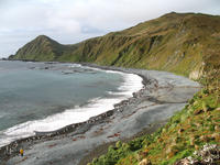
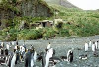
| Description: | Midway between Australia and the Antarctic (1,500 km south-east of Tasmania), lies the 34km long x 5km wide Macquarie Island. At the meeting of the Indo-Australian tectonic plate with the Pacific plate, a raised crest of the undersea Macquarie Ridge is exposed; a ridge that gives us present-day Macquarie Island. The site is the only known area on earth where rocks from the earth's mantle (6km below the ocean floor) are actively being exposed above sea-level; a phenomenon of major geoconservation significance. The exposed rocks are examples of pillow basalts and other extrusive rocks. --WHMNet paraphrase from the description at WHC Site, where additional information is available. | |
| Macquarie Island lies in the southwest corner of the Pacific Ocean, about half-way between Australia and Antarctica. Politically, it has formed part of the Australian state of Tasmania since 1900 and became a Tasmanian State Reserve in 1978. In 1997 it became a world heritage site. It was a part of Esperance Municipality until 1993, when the municipality was merged with other municipalities to Huon Valley. The Australian Antarctic Division (AAD) maintains a permanent base on the island. The base's residents, the island's only inhabitants, range in numbers from 20 to 40 people throughout the year. --Wikipedia. Text is available under the Creative Commons Attribution-ShareAlike License. | ||
| Source: | http://whc.unesco.org/en/list/629 | |
| Reference: | 1. UNESCO World Heritage Center, Site Page. | |


