You are in: Africa -> South Africa -> Richtersveld Cultura... , and traditional search or Image Gallery will yield results of this site only
Richtersveld Cultural and Botanical Landscape
| Site number: | 1265 |
|
| Type of site: | Cultural | |
| Date: | - | |
| Date of Inscription: | 2007 | |
| Location: | Africa, South Africa, Northern Cape | |
Up to 75 images are shown here. Click on each for more details or on Image Gallery for more images.
| Description: | In the north-west part of South Africa lies the 160,000 ha Richtersveld Cultural and Botanical Landscape of vivid mountainous desert - a cultural landscape communally owned and managed. This site continues the Nama people’s semi-nomadic pastoral livelihood, revealing cyclic patterns that may have persisted in Southern Africa for two millennia. This is the only place in the world where the Nama still construct portable houses, haru oms. The site has seasonal migrations and grazing grounds, stockposts (bases employed by the herders as they migrate with their sheep and cattle herds on a seasonal basis) and Nama rush mat houses, tiny hemispherical moveable structures, composed of a wooden frame of crisscrossed wooden hoops, enclosed with fine braided mats of local rushes. This property was inhabited by pastoralists to collect medicinal and other plants; it has a strong oral tradition allied with various places and characteristics of the landscape. --WHMNet paraphrase from the description at WHC Site, where additional information is available. | |
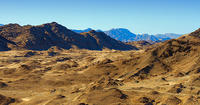
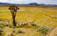
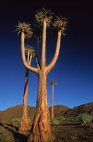
| The Richtersveld is situated in South Africa’s Northern Cape province, a mountainous desert landscape characterised by rugged kloofs, high mountains and dramatic landscapes. It is full of changing scenery from flat sandy plains, to craggy sharp mountains of volcanic rock and the lushness of the Orange River, which forms the border with neighbouring Namibia. Located in South Africa's northern Namaqualand, this arid area represents a harsh landscape where water is a great scarcity and only the hardiest of lifeforms survive. A favourite amongst nature travellers to South Africa, the landscape is sometimes described as "martian". Though barren and desolate at first glance, closer examination reveals the area to be rich in desert lifeforms, with an array or unique species specially adapted for survival. Temperatures are extreme, and in summer can reach over 50°C. Rain is a very, very rare event. The northern part of the area was was proclaimed as a National Park in 1991 after 18 years of negotiation with the local Nama people, who continue to live and graze their livestock in the area. It has an area of 1,624.45 square kilometres. In June 2007, the "Richtersveld Cultural and Botanical Landscape", just to the south of the National Park and an area of equivalent size and beauty, was named a UNESCO World Heritage Site. Unlike the National Park, the World Heritage Site is not subject to diamond mining and is as a result the more pristine of the two areas. Home to an impressive 650 plant species, this park boasts the world’s largest diversity of succulents and represents a prime example of one of the most interesting mega-ecosystems in the world, the Karoo. The area is inhabited by Nama and other peoples. The local community, which owns the entire area, manages the National Park in conjunction with South African National Parks and is entirely responsible for management of the World Heritage Site. Both areas are used by traditional nomadic herders to practice their ancient lifestyle and culture. It is the last place where the traditional way of life of the KhoiKhoi (of whom the Nama are the surviving clan), who once occupied the entire south-western part of Africa, survives to any great extent. --Wikipedia. Text is available under the Creative Commons Attribution-ShareAlike License. | ||
| Source: | http://whc.unesco.org/en/list/1265 | |
| Reference: | 1. UNESCO World Heritage Center, Site Page. | |


