You are in: Oceania -> Australia -> Purnululu National Park, and traditional search or Image Gallery will yield results of this site only
Purnululu National Park
| Site number: | 1094 |
|
| Type of site: | Natural | |
| Date of Inscription: | 2003 | |
| Location: | Australia, Western Australia | |
Up to 75 images are shown here. Click on each for more details or on Image Gallery for more images.
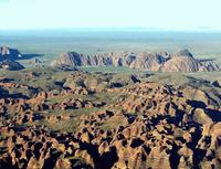
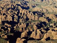
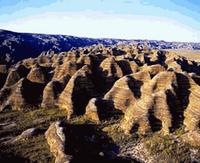
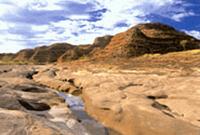
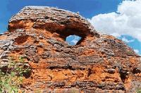
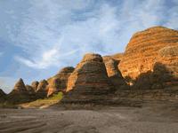
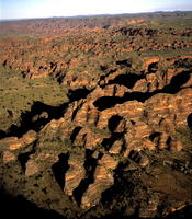
| Description: | Located in the state of Western Australia is the Purnululu National Park (239,723 ha). 20 million year eroded Devonian-age quartz sandstone is found on site within the broken up Bungle Bungle Range, where erosion has created a series of beehive-shaped towers or cones. Distinct surface markings with regular horizontal bands of dark-grey cyanobacterial crust (single-celled photosynthetic organisms) can be found on the steep-sloping surfaces of these cones. The interaction of geological, biological, erosional and climatic phenomena all amount to the unique existence of these outstanding examples of cone karst. --WHMNet paraphrase from the description at WHC Site, where additional information is available. | |
| Purnululu National Park is a World Heritage Site in Western Australia, 2054 km northeast of Perth. The nearest major town is Kununurra to the north, or Halls Creek to the south. Access to the park by road is via Spring Creek Track, from the Great Northern Highway approximately 250 km south of Kununurra, to the track's end at the visitor centre. The track is 53 km long and is usable only in the dry season (about April 1 to December 31), and only by four-wheel-drive (4WD) vehicles. Safely navigating it takes approximately 3 hours. Access by air is less demanding; helicopter flights are available, from Turkey Creek Roadhouse at Warmun, 187 km south of Kununurra, and light aircraft, from Kununurra. Purnululu is the name given to the sandstone area of the Bungle Bungle Range by the Kija Aboriginal people. The name means sandstone or may be a corruption of bundle grass. The range, lying fully within the park, has elevations as high as 578 metres above sea level. It is famous for the sandstone domes, unusual and visually striking with their striping in alternating orange and grey bands. The banding of the domes is due to differences in clay content and porosity of the sandstone layers: the orange bands consist of oxidised iron compounds in layers that dry out too quickly for cyanobacteria to multiply; the grey bands are composed of cyanobacteria growing on the surface of layers of sandstone where moisture accumulates. --Wikipedia. Text is available under the Creative Commons Attribution-ShareAlike License. | ||
| Source: | http://whc.unesco.org/en/list/1094 | |
| Reference: | 1. UNESCO World Heritage Center, Site Page. | |


